After
internet time we walked up to the locked gates then turned to walk
back down. A guy yelled out to us and we tried to indicate that we
were just walking. John drove us back down and just above the village
we were met by a Gendarme car with 3 guys getting out. All in combat
gear but not swinging automatic weapons. One directed us to the left
the other to the right so John just laughed and pointed out what was
happening. It lightened the mood and we just stopped in the middle of
the road. One guy spoke English and asked for passports. All OK and
we could leave. They followed us into town. I jumped out and asked
him where to buy a SIM and he told me 100m further. He then
stopped us to say we had passed the shop. Friendly guys.
I
went into the shop to recharge Johns Turkish Vodaphone SIM but the
system was not working. I bought a Turkcell sim and 6 GB for A$25
quite expensive here. It took a long time with the lady trying about
6 times but the connection kept failing so she’d start again.
Finally we had the SIM connected but no data. She said to wait awhile
and I'd receive a message.
The
fruit and veges were good here as well and we bought a loaf of bread
and a few red peppers.
The
land appears dry and brown but the soil looks good where they have
plowed ready for spring planting.
Back
in the land of mosques.
The
road is new in parts with 2 divided lanes for a stretch, then back to
one, but they are working on it.

These
sacks are full of dried grass. And are numerous.

The Turkish flag once more is proudly flown.
 A
newly created lake. The roads are still on the OSMAnd map but
underwater now, google does not even show the lake. We often find
that both maps are very different in what they show. We find that
generally OSMAnd is more correct more of the time.
A
newly created lake. The roads are still on the OSMAnd map but
underwater now, google does not even show the lake. We often find
that both maps are very different in what they show. We find that
generally OSMAnd is more correct more of the time. One
can still see the road exciting the lake on the far side.
One
can still see the road exciting the lake on the far side.
Rubbish
everywhere so sad to see.

A
playground.

Birds
are few and far between until a flock of these black crow like bird.

 The
new road has new barriers still being erected to keep the blown snow
off the road.
The
new road has new barriers still being erected to keep the blown snow
off the road.
A
deserted village.

The
air is very full of smoke. I assume it is the small villages cooking
and heating fires burning mainly the dried animal dung.
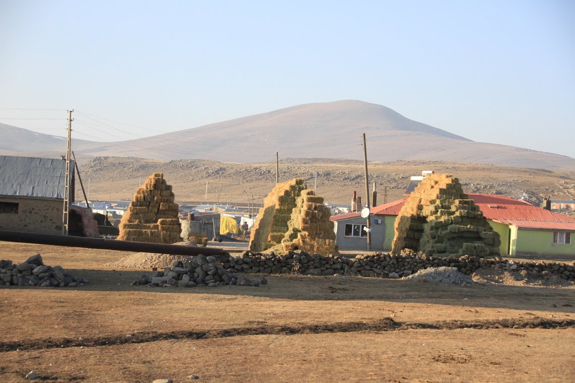
 Pyramids
of hay covered and uncovered along with the piles of dried dung
“cakes”.
Pyramids
of hay covered and uncovered along with the piles of dried dung
“cakes”.
The
local bus dropped shoppers off back in their village with their boxes
of veges and loaves of bread.
It
was because we followed the bus thinking he’d continue out of town
that we ended upon the wrong road. Anyhow we just continued as it
looked like it may go somewhere. It was not on our map so driving
blind.

It was the time of the evening when animals were being herded
home for the night. This guy on the donkey were bringing up the
rear.
We
found a lovely camp overlooking a very smokey valley. A cold night.
John pumped some of the hot water via the outside shower into our
tank to warm it a little.
