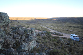
Heard the bus leave at 6am so the road is cleared. Drove out about 7am as
we need to make some miles. The skinny road around the hill was very
well maintained and we made good time. Also being around the side of
the hill we had good visibility of on coming traffic which were few.
We were going to take a white bypass south of Cotahausi but it had a sign indicating that there was a 5 tonne limit to road. Finally dove into Cotahausi and refueled.
As we were leaving we read a sign saying at the 258km mark the road was only passable for 15 minutes at 10am and 3pm and for 1 hour between 12 and 1pm. it was only 9.30am so we parked outside town as no camions (trucks) were allowed. We walked passed two big dump trucks as we walked into the main square to get some printing done.
We drove out of town and up switch backs. The 258km mark was only 20kms from us, so we would probably have a wait. The 258km came and went with no roadworks to be seen. Glad we hadn't decided to wait out the time at the bottom of the hill…. Don’t seem they use signs very effectively.

We turned off on a yellow rd to take a short cut to Maucallacta an archeology site above the town of San Antonio. We passed some amazing colors in the hills. The road started as a yellow and slowly degraded to a “Not passable”. The rains in March had washed a lot of material off volcan coropuna (7244m) onto the track.
Another set back.

We drove out and puts some rocks across the road to indicate that it was not passably. Drove the long way around then turned back north towards the ruins on a white road.
We camped at 3700m alt on the
side of the road with Internet!!! Difficult to get level though. Still a little down in the back despite perching on some large rocks.

